Gulf of Mexico ‘dead zone’ measures below average this year
NOAA: River discharge is a key factor
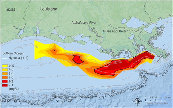
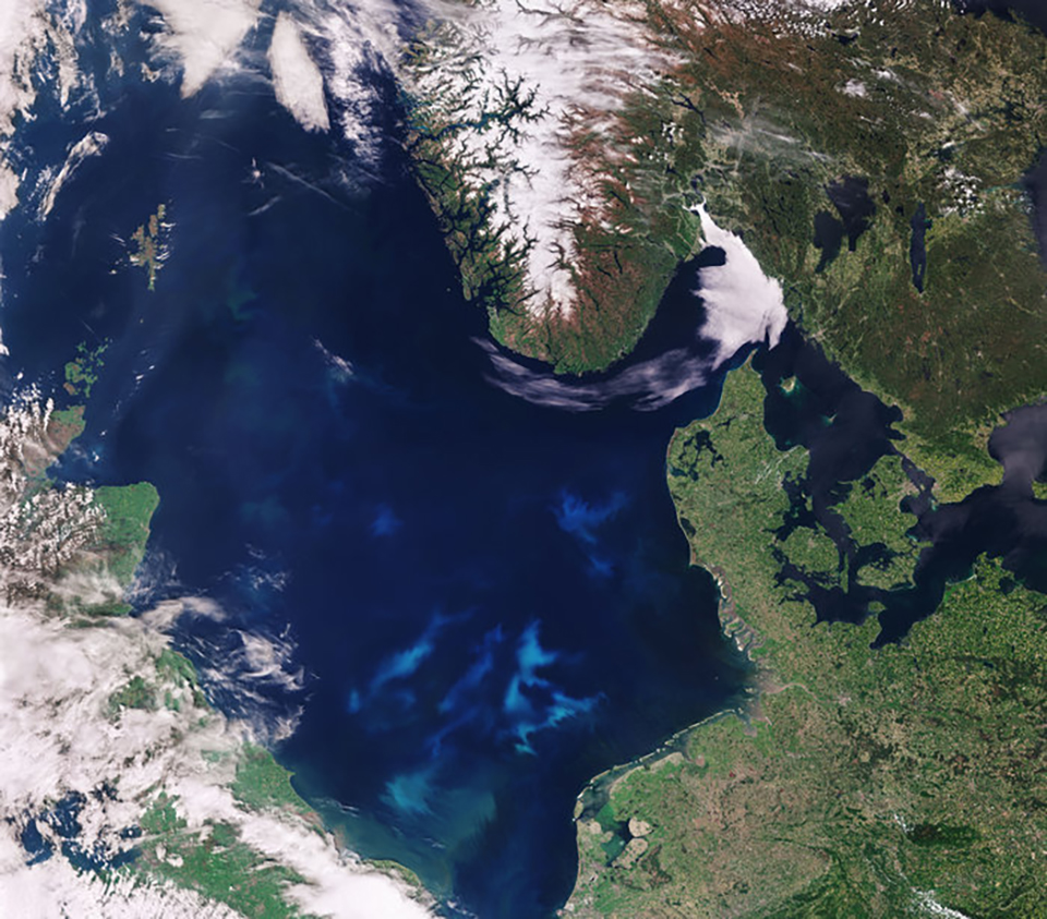
According to NOAA-supported scientists, this year’s Gulf of Mexico “dead zone” – an area of low to no oxygen that can kill fish and marine life – is approximately 3,275 square miles. That’s more than 2 million acres of habitat potentially unavailable to fish and bottom species – larger than the land area of Rhode Island and Delaware combined.
In June, NOAA forecasted an average-sized hypoxic zone of 5,364 square miles, based primarily on Mississippi River discharge and nutrient runoff data from the U.S. Geological Survey. NOAA said that the measured size fell within the uncertainty range for the models, which factors in some of the inherent environmental variability of the system, such as the below-average river discharge over the summer.
“This summer was an unusual year for Gulf hypoxia,” said Nancy Rabalais, principal investigator and professor at Louisiana State University and Louisiana Universities Marine Consortium (LUMCON). “The Mississippi River discharge was below the summer average. The lower flow is unable to support the normal layering of the water column, allowing dissolved oxygen from the surface waters to diffuse more easily to the seabed. The ecosystem subject to hypoxia was characterized by lower turbidity, lower algal biomass, lower nutrients and higher salinity in the surface waters.”
The measurement was made during an annual survey cruise, led by a team of scientists from Louisiana State University and the LUMCON aboard the R/V Pelican during the last week of July. The information gathered is a key metric used by the Mississippi River/Gulf of Mexico Watershed Hypoxia Task Force to measure progress toward achieving their five-year average target of 1,900 square miles or smaller by 2035. The cruise provides a one-time snapshot of the dead zone; the five-year average captures the dynamic and changing nature of the zone over time.
![Ad for [membership]](https://www.globalseafood.org/wp-content/uploads/2025/07/membership_web2025_1050x125.gif)
“Yearly measurements enable us to help decision-makers fine-tune strategies to reduce the size of the hypoxic zone in these waters and mitigate harmful impacts to our coastal resources and economy,” said Nicole LeBoeuf, director of NOAA’s National Ocean Service. “While some hypoxia is natural, the size and scale of what we’ve seen here in the last several decades is unusually large and detrimental. Our measurements and analyses can empower communities to take action to protect their coasts and contribute to the region’s economic sustainability.”
The five-year average dead zone size (also known as the hypoxic zone) is now 4,280 square miles, which is more than two times larger than management targets. Since records began in 1985, the largest hypoxic zone measured was 8,776 square miles in 2017.
Each year, excess nutrients from cities, farms and other sources in upland watersheds drain into the Gulf and stimulate algal growth during the spring and summer. The algae eventually die, sink and decompose. Throughout this process, oxygen-consuming bacteria decay the algae and consume the oxygen. The resulting low oxygen levels near the bottom are insufficient to support most marine life, rendering the habitat unusable and forcing species to move to other areas to survive.
Exposure to hypoxic waters has been found to alter fish diets, growth rates, reproduction, habitat use and availability of commercially harvested species like shrimp. For the first time, scientists from NOAA Fisheries and North Carolina State University started using an experimental model this year to better understand where shrimp could be found relative to the hypoxic zone.
“The dead zone in the Gulf of Mexico is a stark reminder that water quality and land stewardship go hand in hand,” said Radhika Fox, Environmental Protection Agency (EPA) Assistant Administrator for Water. “At EPA, we recognize this and are investing $60 million through President Biden’s Bipartisan Infrastructure Law in work that states are doing to reduce excess nutrients that feed the dead zone.”
Follow the Advocate on Twitter @GSA_Advocate.
Now that you've reached the end of the article ...
… please consider supporting GSA’s mission to advance responsible seafood practices through education, advocacy and third-party assurances. The Advocate aims to document the evolution of responsible seafood practices and share the expansive knowledge of our vast network of contributors.
By becoming a Global Seafood Alliance member, you’re ensuring that all of the pre-competitive work we do through member benefits, resources and events can continue. Individual membership costs just $50 a year.
Not a GSA member? Join us.
Author
Related Posts
Intelligence
NOAA launches mapping tool for marine species to prepare for climate change
NOAA Fisheries has launched a new mapping tool for marine species, which will help prepare fisheries management for climate change.
Intelligence
NOAA releases new marine aquaculture permitting guide
NOAA has released a new guide to help navigate the federal marine aquaculture permitting process in U.S. waters.
Responsibility
Study: 2021 breaks record for hottest ocean temperature
New research shows the ocean temperature in 2021 was the hottest ever recorded by humans, and the effects of ocean warming are "far-reaching."
Responsibility
NOAA invests millions to take on harmful algal blooms
The National Oceanic and Atmospheric Administration announced $15.2 million in funding to research harmful algal blooms throughout U.S. coastal and Great Lakes waters.