Can GIS-based proxy models estimate aquaculture production capacity?
Researchers in Spain demonstrate how GIS-based tools can help bridge the gap between zoning maps and real-world aquaculture practices
Researchers in Spain say an advanced data-mapping technology can help determine the carrying capacities for marine zones designated for aquaculture.
Using a Geographic Information System (GIS)-based evaluation tool, the team showed that the percentage of high-capacity areas in pre-selected allocated zones increased when self-limiting factors were set to their maximum values, with “tons of feed per hectare” having the most significant impact.
These self-limiting factors are linked to best practices, such as reducing feed volume or improving spatial organization within concession areas. The findings of the study, authored by Drs. Linda Fourdain, Aitor Forcada, Pablo Sánchez-Jerez and Kilian Toledo-Guedes from the University of Alicante (Alicante, Spain), demonstrate how a proxy-based carrying capacity layer can support spatial planning and adaptative management of Mediterranean finfish aquaculture.
“Our research demonstrates how GIS-based tools can help bridge the gap between zoning maps and real-world aquaculture practice,” corresponding author Dr. Fourdain told the Advocate. “By estimating the production carrying capacity within allocated zones in the Spanish Mediterranean, we show how science-based planning can guide more efficient use of space, reduce environmental risks and identify high-potential areas for future farms. This approach supports both policymakers and producers in advancing aquaculture that is sustainable, resilient, and better integrated with coastal management.”
![Ad for [BSP]](https://www.globalseafood.org/wp-content/uploads/2025/07/BSP_B2B_2025_1050x125.jpg)
Aquaculture spatial planning is a thematic layer within marine spatial planning (MSP) that focuses on identifying suitable locations, determining appropriate scales and managing farming operations to align with environmental objectives while minimizing conflict with other ocean uses. MSP is a public, ecosystem-based process for analyzing and allocating sea activities to minimize conflicts and promote sustainability. It plays a pivotal role in ensuring the sustainable growth of aquaculture, while balancing ecological limits and human activities.
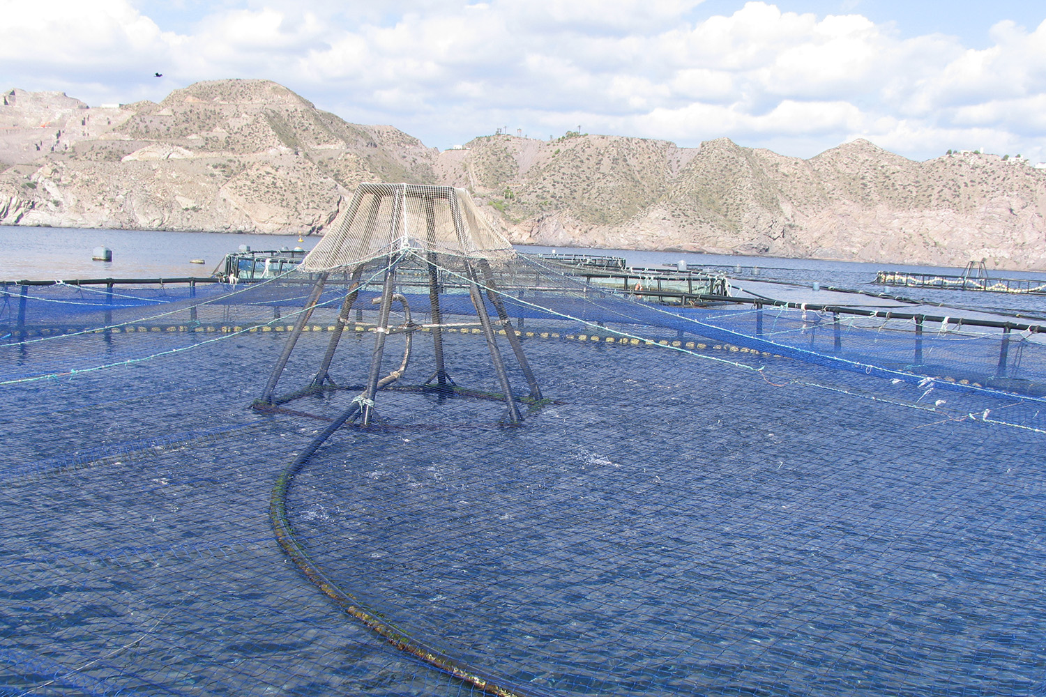
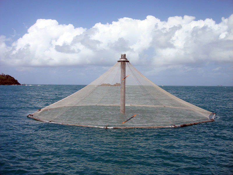
In the Mediterranean, this layer is operationalized through allocated zones for aquaculture (AZAs) – areas formally identified as the main site for aquaculture where biophysical, socio-economic and governance conditions have been studied to support the activity with minimal risk or overlap.
AZAs within MSP are considered an effective tool to help address many of these factors and to foster a participatory approach while facilitating consensus between stakeholders. In this regard, AZA represents a valuable transnational and cross-sector tool enabling aquaculture activities to be framed within MSP and can be defined as areas resulting from a zoning process of physical planning where there are no negative interferences with other coastal activities or users and environmental conditions allow the development of the activity.
The study used a GIS-based proxy model to assess the production carrying capacity of allocated zones for aquaculture in the Mediterranean region of Spain. The model integrates georeferenced data on factors like distance to habitats, depth, current velocity, and employment. The study area was divided into 1×1 km cells, with unsuitable areas removed based on zoning criteria. Three self-limiting factors were analyzed separately: unit cost of production, tons of feed per hectare and cage arrangement.
The results of the analysis of carrying capacity revealed significant spatial variability in carrying capacity across different Autonomous Communities in Spain. The Valencian Community has the largest AZA area (251,856 ha), followed by Catalonia (174,113 ha) and Andalusia (122,035 ha). Most AZAs are classified as MCC, with Andalusia being the only region with HCC (13.1 percent). The distribution of low carrying capacity (LCC) areas varies, with the Valencian Community having the highest proportion (23.3 percent).
On the impact of self-limiting factors on capacity, these factors significantly influence the classification of carrying capacity in the AZAs. The proportion of HCC areas increases when self-limiting factors are set to maximum values, particularly the tons of feed per hectare. In the minimum scenario, LCC areas comprise 37.9 percent of the total, while in the maximum scenario, this drops to 2.4 percent. The factor “unit cost of production” shows minimal impact on carrying capacity compared to feed input and space arrangement.
Regarding the integration of GIS and carrying capacity models, the results also demonstrated the feasibility of combining carrying capacity models with GIS tools to enhance sustainable aquaculture development in the Spanish Mediterranean. The resulting model integrates technical, environmental, social and economic factors; it estimates production carrying capacity in pre-identified Aquaculture Zones for Aquaculture (AZAs); the GIS tools facilitate the overlapping of information layers for better decision-making; and is adaptable and should be regularly updated with new data and stakeholder feedback.
“Our findings demonstrate how a proxy-based carrying capacity layer can support spatial planning and adaptative management of Mediterranean finfish aquaculture,” stated the authors.
Environmental factors are important and significantly influence the carrying capacity for aquaculture, affecting production feasibility and ecological sustainability. Depth is a critical determinant for carrying capacity distribution, with shallow areas often designated as Low Carrying Capacity (LCC). High Carrying Capacity (HCC) zones are typically found at depths greater than 50 meters, benefiting from better waste dispersion and water circulation. Areas with high current speeds improve oxygenation and nutrient dispersion, enhancing conditions for aquaculture.
This study reflects the importance of considering self-limiting factors, where farmers could enhance their capacity through the implementation of best aquaculture practices. The model represents a valuable tool for management applications by public administrations and aquaculture farmers. It can facilitate the granting of new concessions or pinpoint sites with significant carrying capacity, aiding in informed decision-making processes.
Should the standard terminology describing ‘offshore’ aquaculture be changed?
With ongoing advances in artificial intelligence, these techniques are now able to automate data processing, refine factor weightings and enhance predictive accuracy in GIS-based carrying-capacity assessments, thereby transforming the models into dynamic decision-support tools that deliver real-time and high-precision insights for aquaculture spatial planning and management.
“The practical value of GIS-based carrying capacity models ultimately hinges on two enablers: data access and the capacity of end-users to run the workflows. With targeted staff training, open-source software such as QGIS (QGIS.org, 2023), and clear, step-by-step documentation, public agencies and aquaculture companies can unlock the full potential of these models-turning them into powerful tools for informed decision-making and more efficient spatial planning and management,” concluded the authors. “We therefore recommend that technical support and data-sharing protocols be developed in parallel with model deployment so that decision-makers can move from static suitability maps to routine, evidence-based zoning updates.”
Now that you've reached the end of the article ...
… please consider supporting GSA’s mission to advance responsible seafood practices through education, advocacy and third-party assurances. The Advocate aims to document the evolution of responsible seafood practices and share the expansive knowledge of our vast network of contributors.
By becoming a Global Seafood Alliance member, you’re ensuring that all of the pre-competitive work we do through member benefits, resources and events can continue. Individual membership costs just $50 a year.
Not a GSA member? Join us.
Author
-

Editor Emeritus
Related Posts
Health & Welfare
Animal density, pathogen load related factors in disease outbreaks
Consideration of the effect of animal density usually does not include the critically important contribution of pathogen concentration to the dynamics of disease outbreaks.
Responsibility
Do you know offshore aquaculture when you see it?
Researchers have determined that a definition of “offshore aquaculture” was necessary to critically assess the impacts and benefits of moving fish farming operations “slightly farther and slightly deeper” out to sea.
Intelligence
‘Spatiotemporal patterns’ indicate improving perceptions of aquaculture
A study led by University of California Santa Barbara researchers has found that public sentiment toward aquaculture improves over time, a potentially important development with growing interest in offshore aquaculture.

Fisheries
A deep learning model for short- and medium-term predictions of spatiotemporal distribution of marine fishing effort
A deep learning model to predict fishing effort can simultaneously interpret and integrate fishing intensity and environmental factors.