Putting IUU fishing on the map: Global Fishing Watch intends to bring the invisible into view
With $60 million in The Audacious Project funding, the IUU fishing watchdogs is taking aim at illegal activity at sea
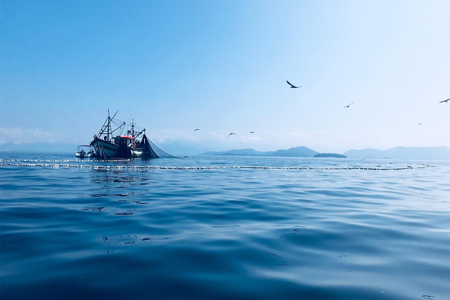
With IUU fishing (illegal, unreported and unregulated fishing) a growing global concern, maintaining open data and increased transparency provide a scalable and equitable approach to transforming the monitoring and management of human activities in the ocean. Tony Long wants to “revolutionize” the process by tapping into the power of artificial intelligence and satellite data.
The Global Fishing Watch (GFW) chief executive believes that with the five-year, U.S. $60 million investment the organization received through The Audacious Project, a TED-housed non-profit, it can support global efforts to improve ocean governance.
Every year, The Audacious Project selects several projects that represent solutions to critical challenges, then connects these initiatives with donors and supporters to accelerate the work. Support for GFW’s new Open Ocean Project was confirmed in June this year, and Long told the Advocate that it was a “clear endorsement of our innovative technology’s potential to address the pressing crisis in our ocean.
“Our primary focus is on reducing destructive and unregulated fishing,” he added. “However, the award through The Audacious Project will enable us to expand our data platform to map various forms of industrial activity at sea.”
![Ad for [membership]](https://www.globalseafood.org/wp-content/uploads/2025/07/membership_web2025_1050x125.gif)
Now underway, the project’s benefactors include the Acton Family Giving, Ballmer Group, Becht Foundation, Oak Foundation, Laura and Gary Lauder and Family, Lyda Hill Philanthropies, MacKenzie Scott, Sea Grape Foundation and the Valhalla Foundation.
Although GFW dedicated more than a year to developing its proposal for The Audacious Project, the Open Ocean Project represents a “natural extension” of ongoing efforts and the organization’s vision to establish a comprehensive, dynamic map of all maritime industrial activities accessible to everyone, he explained.
“With the new funding, we are poised to turn this vision into a tangible reality,” Long said. To protect the ocean, he stressed the need for everything that happens at sea to be seen and understood.
“Currently, most of the ocean remains out of sight, and we don’t have a picture of the true scale of human activity at sea and its cumulative impact,” said Long. “This prevents us from effectively managing maritime activities and taking smart, pre-emptive action to avoid irreparable damage to our ocean’s health. Under the Open Ocean Project, we will shine a light on all industrial human activity at sea – and make it freely available to the world.”
Long said accessible data and analytics will help governments detect risk of IUU fishing activity and support more targeted and effective patrols. It will also enhance enforcement partnerships, such as with the U.S. Coast Guard, and empower governments “to hold rogue actors to account.” At the same time, the project’s global mapping will help identify those industrial fishing vessels that are encroaching on artisanal fishing grounds or other countries’ exclusive economic zones (EEZs), Long said. It will also support marine spatial planning processes by providing data evidence, he added.
With ground-breaking factory trawler Ecofive, Bluewild is building a blueprint for greener fishing
Enabling informed ocean protection
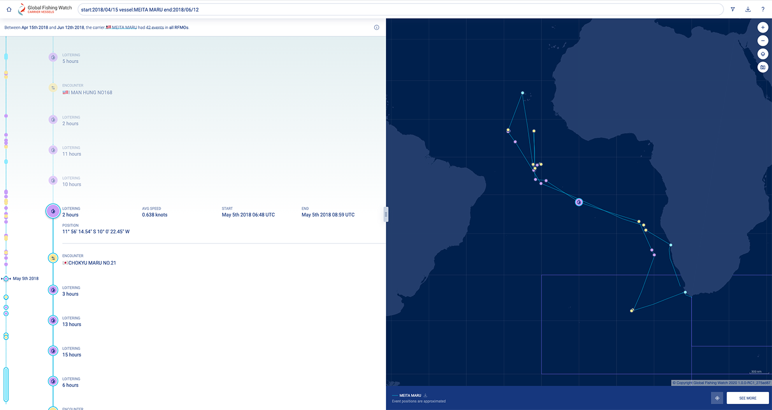
Leveraging open data and emerging technology, the non-profit plans to publicly map more than 1 million ocean vessels and fixed infrastructure to better understand sea activities. It’s already built the first-ever map to visualize and track 70,000 fishing vessels in near real-time, and currently, more than 20 countries use its map and data, with 12 of these publicly sharing their vessel tracking data. The organization also supports governments with reports and research, and several of its partners advocate for transparency and technology in ocean governance.
“We’re informing and influencing policies and legislation to facilitate data sharing and transparency,” Long said. “We want to go much further. Thanks to our Open Ocean Project, we can. We will deepen and expand our partnerships with governments to improve the management of their waters by using our enhanced technology platform and by co-creating tools that meet their own specific needs.”
“We can develop our platform to support implementation of the global commitment to protect 30 percent of the ocean by 2030, and we can demonstrate how public data can aid the new High Seas Treaty,” he added.
The Open Ocean Project merges GPS data and extensive satellite imagery, employing machine learning to publicly display the activities of industrial fishing vessels, small-scale fishing boats and cargo ships. It also maps stationary sea infrastructure, offering an unprecedented online view of our impact on the blue planet.
Today, anyone can freely access satellite imagery to explore every road and building on land with a few clicks of a mouse, and GFW wants to do the same for the ocean: a complete, dynamic map of all industrial activity at sea that’s free for anyone to view and use.
“Under the Open Ocean Project, we will use satellite data and machine learning to monitor and map all large-scale fishing vessels – some 350,000 vessels – along with hundreds of thousands of small-scale fishing boats, and all large non-fishing vessels (>200,000) like cargo ships, cruise liners and oil tankers,” said Long. “We will also reveal all oil and gas rigs, mining and other fixed infrastructure like aquaculture pens and wind farms. The result will be a new detailed understanding of human activity as well as a tool to monitor it, powering solutions to numerous ocean challenges.”
According to GFW, ocean stewardship efforts face challenges due to the lack of accurate information, hindering governments’ ability to monitor fishing activities and other sea-based human actions. The organization is confident that improved open data and transparency can help overcome these obstacles, providing visibility and a comprehensive understanding of sea activities.
“In the coming years, GFW will generate, unlock, process and share even more data for the common good. This will advance scientific understanding, transparency and accountability and drive fairer, smarter policies that protect our ocean and those whose livelihoods depend on it,” Long said.
In 2024, it will release its “first significant dataset” of non-fishing activities to the public and begin collaborating with partners to expand its impacts to include small-scale fisheries, high-seas management, ocean-climate solutions and deep-sea mining, he said. The project’s roadmap includes:
- Three-year goals: Develop and share all data
- Five-year goals: Collaborate with partners to drive policy, management and enforcement actions using the new data
- Seven-year goals (by 2030): Achieve lasting positive change in fisheries, biodiversity and climate change
The data platform and enabling technologies produced by the project will serve as the foundation for GFW’s engagement with governments and international institutions on improving fisheries management and marine protection, Long said.
It will also power partnerships with other organizations to drive positive change in areas such as climate mitigation, renewable energy, marine pollution and threats to ecosystems from shipping and extractive industries.
Data access will occur through three channels: a free online mapping tool for users to explore datasets interactively, a bulk download portal for researchers and long-term interoperability with other ocean data systems via application programming interfaces (APIs). This ensures seamless integration into various apps or platforms, enabling real-time data flow between systems.
“This is how we are contributing to the creation of digital infrastructure of the ocean,” Long said.
Meanwhile, the organization will also look to raise an additional U.S. $60 million to match the funds secured through The Audacious Project, to assist the program.
“[This] will support our work with governments and civil society to harness open data and technology, and usher in a new era of transparency toward better ocean governance,” Long said.
Can an underwater artificial intelligence bot detect IUU fishing?
Mitigating mounting ocean pressure
For GFW to effectively detect all fishing vessels, including those evading tracking, requires the start-off point of detecting all maritime activities, Long explained. It then has to determine which objects it sees on the water are fishing vessels and to match this information to fishing vessels that are using an automatic identification system (AIS) or vessel monitoring system (VMS).
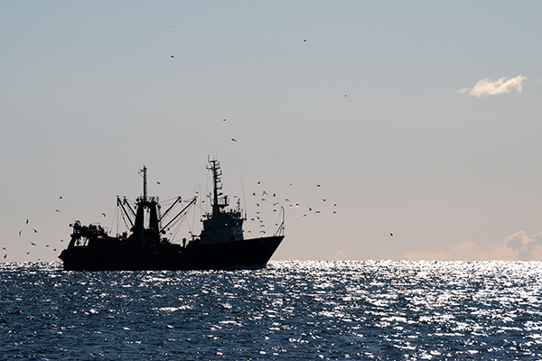
All the other things it sees are other types of vessels or fixed infrastructure, including more than 300,000 oil tankers, container ships, ferries, yachts and other non-fishing vessels and around 30,000 individual offshore structures.
“Global maritime traffic has quadrupled in the last two decades, intensifying pressure on marine ecosystems. By offering open data on non-fishing vessels, we can collaborate with researchers and organizations to explore a whole new host of questions about our impact on the marine environment,” Long said.
“For instance, we will be able to quantify carbon emissions from shipping vessels to support the decarbonization of the industry. We will also track oil tankers and potentially coal and natural gas shipments. By highlighting this supply chain, we can shed light on the full cost of the fossil fuel industry. Furthermore, we can investigate the impact of shipping and vessel traffic on marine life, aiding efforts to mitigate collisions with whales, and reduce noise pollution.”
Another key aspect of mapping non-fishing activity is the interaction between fishing vessels with offshore infrastructure and associated vessel traffic, he said.
“While some fishing vessels avoid fixed infrastructure, for example, to avoid net entanglement, other fishing activities benefit from it. For example, a variety of fish species are known to aggregate around artificial hard structures like oil platforms.”
Long also pointed out that other industrial uses of the ocean are increasing rapidly – “much faster than industrial fishing,” though it’s still the largest single industrial use of the ocean by humans.
“In the future, these other industrial uses will increasingly compete with and impact fisheries, so if we want to look after the health of the ocean and preserve healthy fisheries, we need to look at all of these industrial uses,” he said.
The initiative will also expand fishing activity monitoring to some important geographies not yet covered or not yet covered well enough, with Long confirming that there a few regions where the organization currently have little-to-no publicly available information about fishing activities.
He highlighted that in the southern Mediterranean Sea and the western and northern African coasts, almost all fishing vessels do not broadcast AIS, while in Southeast Asia, particularly the South China Sea, AIS reception is often very poor.
As a result, much of the fishing activity in these regions is not currently captured in public monitoring systems. “Our satellite imagery technology will allow us to publicly reveal this activity,” Long said.
Now that you've reached the end of the article ...
… please consider supporting GSA’s mission to advance responsible seafood practices through education, advocacy and third-party assurances. The Advocate aims to document the evolution of responsible seafood practices and share the expansive knowledge of our vast network of contributors.
By becoming a Global Seafood Alliance member, you’re ensuring that all of the pre-competitive work we do through member benefits, resources and events can continue. Individual membership costs just $50 a year.
Not a GSA member? Join us.
Author
-

Jason Holland is a London-based writer for the international seafood, aquaculture and fisheries sectors. Jason has accrued more than 25 years’ experience as a B2B journalist, editor and communications consultant – a career that has taken him all over the world. He believes he found his true professional calling in 2004 when he started documenting the many facets of the international seafood industry, and particularly those enterprises and individuals bringing change to it.
Related Posts
Fisheries
Can a data-sharing tool eliminate IUU fishing and make seafood supply chains more reliable?
The Sustainable Fisheries Partnership’s new data-sharing tool helps users identify environmental risks and eliminate IUU fishing in seafood supply chains.
Fisheries
Global analysis of where fishing vessel tracking devices are disabled provides insights into IUU fishing
A new dataset of intentional disabling of identification devices by fishing vessels provides new insights into IUU fishing activities.
Fisheries
Could an electric-pulsed device help mitigate shark bycatch in longline fisheries?
Research shows that SharkGuard, an electric-pulsed device that attaches to longline fishing rigs, can significantly reduce shark bycatch.
Innovation & Investment
‘We want change’: How a seafood database aims to influence seafood investment decisions
Planet Tracker’s seafood database evaluates seafood companies’ exposure to sustainability risks like overfishing and IUU fishing.