ProtectedSeas releases global interactive map of marine protected areas
Tool consolidates regulatory information for 21,000+ marine protected areas worldwide
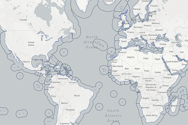
ProtectedSeas, a marine conservation organization associated with the Anthropocene Institute, has launched the first global map of the world’s marine life regulations and their boundaries. Navigator is a free, interactive map of marine protected and managed areas across 220 countries and territories and in 25 languages.
“Navigator brings together independently-verified regulatory information for over 21,000 marine protected areas into one interactive map as a first step toward understanding where current marine protections exist,” said Virgil Zetterlind, director of ProtectedSeas. “We created this one-of-a-kind tool to assist international ocean conservation planning and assessment.”
The Navigator map offers a global view of marine life protections to help inform progress towards international conservation goals, including protecting 30 percent of the global ocean by 2030, which was adopted at the UN Biodiversity Conference in Montreal, Canada, known as COP15.
In addition to a comprehensive inventory of marine protected areas (MPAs), the map includes other marine managed areas such as water protection areas, speed-limit zones to protect marine mammals, fisheries management areas, and other effective areas-based conservation measures (or OECMs).
![Ad for [Aquademia]](https://www.globalseafood.org/wp-content/uploads/2025/07/aquademia_web2025_1050x125.gif)
The Navigator team scoured the globe to compile all marine protection information in the global database for large and small MPAs. The work involved creating the first digital maps for over 2,400 of the areas (or roughly 10 percent of the areas) that were previously only detailed on paper.
The ProtectedSeas team also created a system to evaluate an area’s level of protection from fishing where each area is assigned a Level of Fishing Protection (LFP) score based on an analysis of restrictions on marine life extraction.
“The culmination of eight years of research and development, this open-access tool provides scientists, decision-makers and the conservation community with regulatory information on the world’s marine protected areas to support global MPA analysis, design and management,” the organization stated in a release.
An analysis of Navigator data shows that 3.4 percent of the global ocean is highly protected from fishing based on the ProtectedSeas’ LFP scoring system. On a country level, Palau has the highest percentage of marine area – 79 percent – protected from fishing.
Detailed county- and area-level reports can be viewed and downloaded in Navigator for all marine protected and other managed areas to analyze legal protections relative to species, habitats and other factors to identify potential gaps and inform new protections.
“Many areas we had to map were tough – from digitizing complex boundaries that followed coastlines and excluded islands to following connect-the-dots style descriptions to understand the regulations and boundaries,” said Zetterlind.
The Navigator tool will be showcased during a webinar on Wednesday, June 21 at 10 a.m. PDT. Register for the webinar here.
Follow the Advocate on Twitter @GSA_Advocate
Now that you've reached the end of the article ...
… please consider supporting GSA’s mission to advance responsible seafood practices through education, advocacy and third-party assurances. The Advocate aims to document the evolution of responsible seafood practices and share the expansive knowledge of our vast network of contributors.
By becoming a Global Seafood Alliance member, you’re ensuring that all of the pre-competitive work we do through member benefits, resources and events can continue. Individual membership costs just $50 a year.
Not a GSA member? Join us.
Author
Related Posts
Intelligence
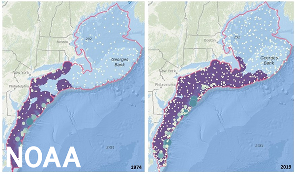
NOAA launches mapping tool for marine species to prepare for climate change
NOAA Fisheries has launched a new mapping tool for marine species, which will help prepare fisheries management for climate change.
Intelligence
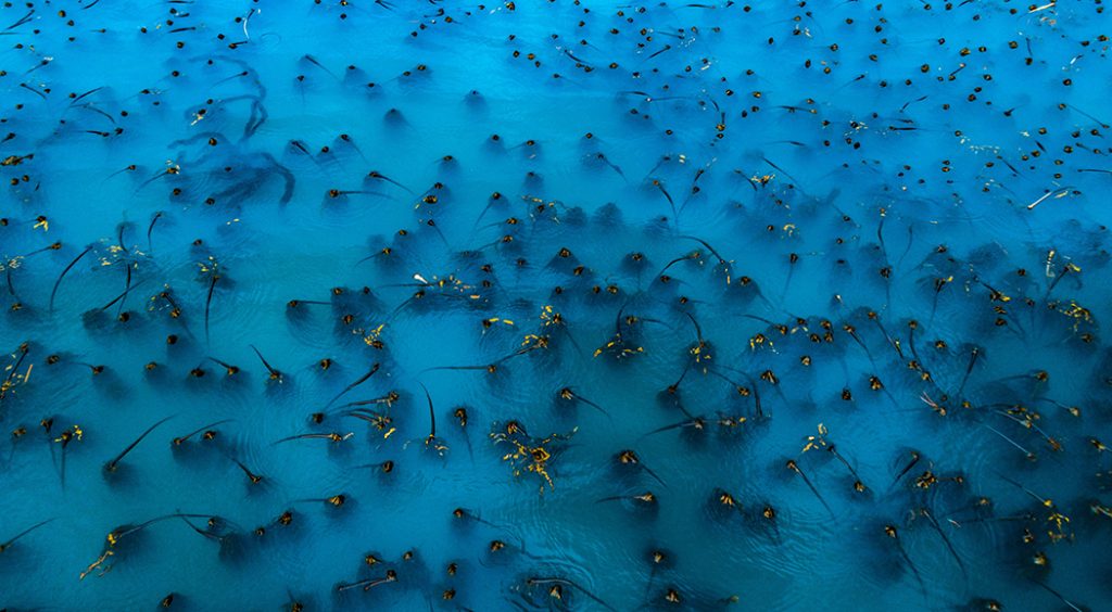
Digital tool aims to map kelp forest canopy and aid ecosystem restoration
U.S. scientists released KelpWatch.org – a digital map of kelp forest canopy that will be instrumental in ecosystem restoration.

Intelligence
AI is becoming an ‘integral part’ of fisheries management and seafood processing
Artificial intelligence (AI) is playing a larger role in seafood, as data is at the heart of the so-called fourth industrial revolution.
Fisheries
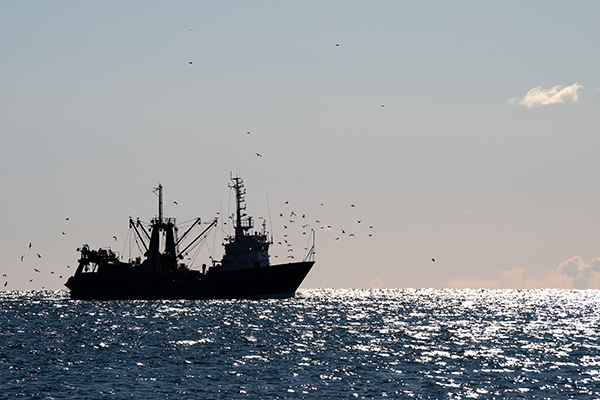
Global analysis of where fishing vessel tracking devices are disabled provides insights into IUU fishing
A new dataset of intentional disabling of identification devices by fishing vessels provides new insights into IUU fishing activities.