Can drones detect early signs of oyster reef deterioration?
Drones offer a more efficient way to survey vital oyster reefs, researchers say
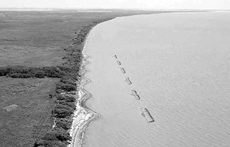
New research from the University of Florida shows that the digital elevation map produced by drone-based lidar – which pushes out rapid laser pulses that can measure distance – can accurately determine the condition of an oyster reef in much less time and with far less labor than old-fashioned manual surveys. That means more reefs can be surveyed faster, giving resource managers a chance to intervene before a reef disappears.
“In the time it takes a person to measure just one or two square meters of reef, you can survey the entire reef structure with a drone,” said Michael Espriella, a postdoctoral researcher at the University of Florida.
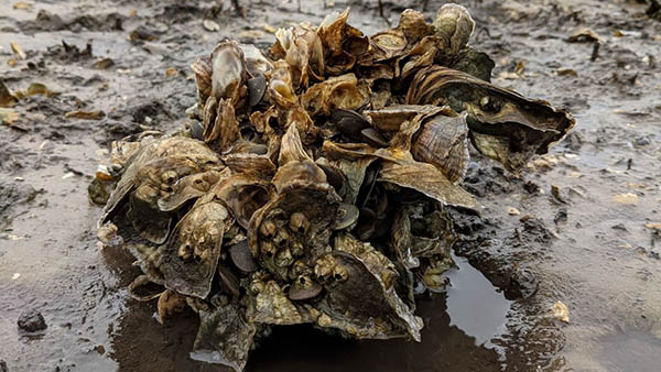
Oyster reefs across the Gulf and Atlantic coasts of the U.S. – vital providers of food, jobs, habitat, shore protection and water purification – are facing steep declines from overharvesting and environmental stressors. But spotting which reefs are at risk of collapse in time to intervene using conventional methods can be labor intensive and impractical.
These collapses of oyster beds have closed fisheries, such as the one in Florida’s Apalachicola Bay. In 2020, the state halted all oyster harvesting for five years while it tried to reverse the damage.
![Ad for [Aquademia]](https://www.globalseafood.org/wp-content/uploads/2025/07/aquademia_web2025_1050x125.gif)
“These drone surveys can have a lot of value in pinpointing early signs of deterioration,” Espriella said. “With enough surveys of reefs around the state, managers could dig deeper into specific situations and hopefully prevent larger collapses.”
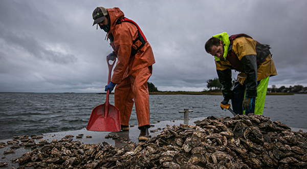
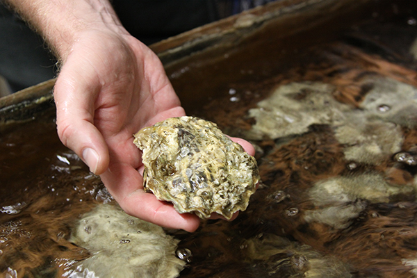
For years, researchers have been looking at better ways to measure the condition of these oyster reefs. One commonly used traditional method relies on walking over the reefs at low tide and placing a square grid on a section of reef. A person then manually counts how many live oysters are in that one square meter of space. That can take more than ten minutes and captures just a tiny part of a reef.
Since a drone flyover of an entire reef takes about the same amount of time as a single manual count, it is much more efficient. Software then produces a three-dimensional model of the reef based on the lidar scan. In their latest work, the research team discovered that the volume of the reef correlates well with the manual oyster counts.
“The volume-to-area ratio had the best parallel to ecological patterns and processes,” Espriella said. “Oysters will often orient themselves in clusters. I think there’s potential to better explore how volume derived from these models can quantify those.”
Follow the Advocate on Twitter @GSA_Advocate
Now that you've reached the end of the article ...
… please consider supporting GSA’s mission to advance responsible seafood practices through education, advocacy and third-party assurances. The Advocate aims to document the evolution of responsible seafood practices and share the expansive knowledge of our vast network of contributors.
By becoming a Global Seafood Alliance member, you’re ensuring that all of the pre-competitive work we do through member benefits, resources and events can continue. Individual membership costs just $50 a year.
Not a GSA member? Join us.
Author
Related Posts
Responsibility
Lightweight oyster reefs reduce coastal erosion
A technique to stimulate oyster growth in the form of an oyster reef breakwater is being developed at Louisiana State University in Baton Rouge.
Responsibility
The Nature Conservancy and Pew team up to support oyster aquaculture, restoration
Funding will help rebuild oyster reefs, as well as promote innovation, resilience and diversity within the oyster aquaculture industry.
Responsibility
As ocean acidification threatens the shellfish industry, this California oyster farm is raising oysters resistant to climate change
Despite the dangers to shellfish posed by ocean acidification, a forward-thinking California oyster farm is producing oysters resistant to climate change.
Health & Welfare
Could a probiotic combination drastically improve oyster larvae survival?
Treating oyster larvae with specific combinations of probiotics can "significantly boost" their survival rates, says a new study.